


Harrison - Kelly Voting District, Nemaha County, Kansas
About
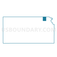
Outline

Summary
| Unique Area Identifier | 586066 |
| Name | Harrison - Kelly Voting District |
| County | Nemaha County |
| State | Kansas |
| Area (square miles) | 12.95 |
| Land Area (square miles) | 12.91 |
| Water Area (square miles) | 0.04 |
| % of Land Area | 99.70 |
| % of Water Area | 0.30 |
| Latitude of the Internal Point | 39.72145100 |
| Longtitude of the Internal Point | -95.96836300 |
Maps


Graphs
Select a template below for downloading or customizing gragh for Harrison - Kelly Voting District, Nemaha County, Kansas


Neighbors
Neighoring Voting District (by Name) Neighboring Voting District on the Map
- Adams Township Voting District, Nemaha County, KS
- Capioma Township Voting District, Nemaha County, KS
- Granada Township Voting District, Nemaha County, KS
- Harrison - Goff Voting District, Nemaha County, KS
- Illinois Township Voting District, Nemaha County, KS
- Mitchell Township Voting District, Nemaha County, KS
Top 10 Neighboring County Subdivision (by Population) Neighboring County Subdivision on the Map
- Illinois township, Nemaha County, KS (450)
- Harrison township, Nemaha County, KS (307)
- Mitchell township, Nemaha County, KS (261)
- Adams township, Nemaha County, KS (194)
- Capioma township, Nemaha County, KS (147)
- Granada township, Nemaha County, KS (105)
Top 10 Neighboring Unified School District (by Population) Neighboring Unified School District on the Map
- Sabetha Unified School District 441, KS (5,079)
- Nemaha Valley Schools Unified School District 442, KS (3,092)
- Vermillion Unified School District 380, KS (2,744)